Indoor Map Building Solution
Indoor Mapping Solution for Integrated
Positioning System (IPS) Services
- Using 3D LiDAR, stable spatial maps are produced even in dynamic environments, technological
- spatial maps that recognize global locations, and radio maps containing radio wave information are
produced at the same time.
-
-
3D LiDAR Scan Pack
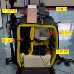
- LiDAR BackPack
- 360 degree camera
- 3D scan matching
-
3D LiDAR Scan Pack
-
-
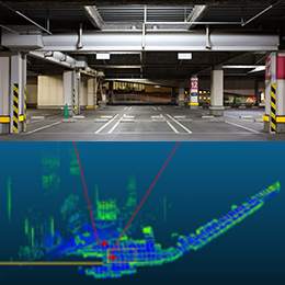
3D mapping algorithm

- 6D position recognition technology
based on LiDAR. - Real-time mapping technology
through dynamic resource
management.
-
3D mapping algorithm
-
-
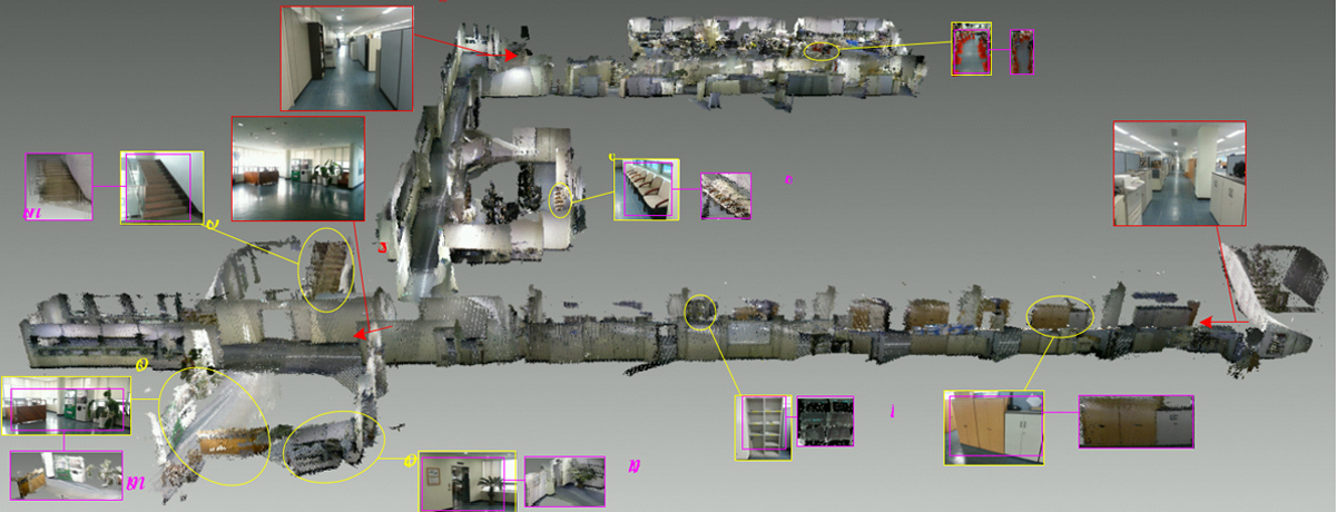
Point cloud data
- Voxel filter technology to reduce
data volume. - High speed data import/storage
based on binary files.
-
Point cloud data
-
-
2D grid map/radio map

- Projection 3 dimensional data
to 2 dimensional. - Offer 2 dimensional floor plan.
- link with various image editing tools.
-
2D grid map/radio map
Location database automatic
production technology
- The positioning infrastructure database indicating the positioning environment information for each representative
point is automatically generated by processing the positioning resource information
(Wi-Fi, BLE, geomagnetic, air pressure, etc.) obtained by the application pedestrian collection and collection device. - Extraction of statistics and maps of POI (points of interest) by positioning the
infrastructure based on dynamically collected data.
- Collection of information about
the positioning environment
-
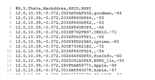
- RSSI-based Fingerprint Map
-
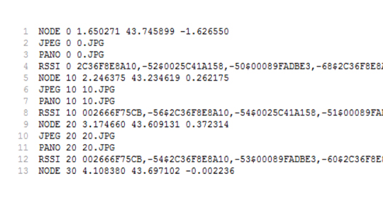
- POI Map